A
Atomic Buoy aka Arish Mel 50°35.03N 2°11.64W
B
Bowleaze 50°37.52N 2°24.53W
C
Chemmers 50°37.58N 2°25.24W
D
Large yellow buoy with light 50°36.38N 2°26.20W
F
Franklin 50°36.50N 2°24.76W
G
South East buoy of group of 4 50°33.67N 2°24.12W
H
0 50°37.30N 2°25.81W
I
2015 New position - N of Northern Entrance 50°36.03N 2°25.93W
J
Bright orange 50°37.00N 2°25.00W
K
temporarily white for 2014 50°37.16N 2°24.10W
L
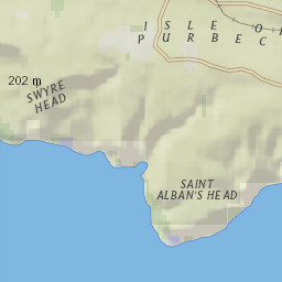
DZA Large yellow can off St Albans Head 50°33.25N 2°06.30W
M
New orange mark 50°36.70N 2°24.19W
O
Repositioned NOT part of the hut start line. 50°37.00N 2°26.38W
P
Hut start line northern limit buoy 50°36.76N 2°26.53W
Q
Hut start line southern limit buoy 50°36.67N 2°26.56W
R
2015 new position - west of Ringstead beach 50°37.40N 2°22.65W
S
East Shambles cardinal mark - 2013 new position 50°31.26N 2°20.08W
T
Orange sphere - changed 2015 50°36.50N 2°25.47W
X
0 50°36.84N 2°25.90W
Y
West Bay outfall buoy 50°33.99N 2°28.91W
N
Northern Entrance - pass through 50°35.70N 2°25.90W
W
Yellow buoy with black shape - CCSC mark 4 50°34.76N 2°27.15W
8
Yellow pillar with Orange flag 50°35.73N 2°26.54W
9
White pillar with Orange flag 50°35.70N 2°26.92W
1
Portland 1 anemometer 50°35.10N 2°24.85W
2
Portland 2 anemometer 50°35.42N 2°25.46W
A
B
C
D
F
G
H
I
J
K
L
M
O
P
Q
R
S
T
X
Y
N
W
8
9
1
2
Map Data
Map Data
Terms of Use
Google map
Google aerial
Google hybrid
Google terrain
OpenStreetMap
OpenStreetMap (MQ)
OpenCycleMap
World streets (ESRI)
World aerial+labels (ESRI)
World aerial (ESRI)
World aerial (MQ)
World topo (ESRI)
World topo (4UMaps)
World public transit (TF)
USGS topo (ESRI)
USGS topo (CalTopo)
USGS + relief (CalTopo)
USFS (CalTopo)
USFS + relief (CalTopo)
US terrain (Stamen/OSM)
US aerial (MQ)
US aerial (NAIP)
US aerial (NAIP)+OSM
US aerial (USTopo)
US county outlines
US state outlines
US National Atlas
US nautical charts
Europe OpenTopoMap
Can. topo (CalTopo)
CanMatrix (CalTopo)
Can. Toporama
Can. Toporama (blank)
Can. GeoBase
Can. GeoBase (blank)
Italy IGM 1:25k
Italy IGM 1:100k
OpenSeaMap (MQ)
OpenSeaMap (OSM)
National Geographic
Center:
50.57901,-2.27093
Map created at
GPSVisualizer.com
NGS maps from
ESRI/ArcGIS
Report a map error
1 km
_files/mapcontrols2.png)
_files/shadow.png)


_files/google4_hdpi.png)
_files/mapcnt6.png)
_files/mapcnt6_hdpi.png)
_files/yellow.png)